
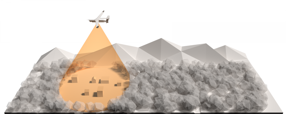
SAR radar systems are capable of automatically turning SAR imagery into multiple real-time data products through several available modes. Due to the multimode capabilities of SAR systems, operators and analysts have considerable flexibility in switching and combining modes to produce intelligent results for multiple applications:
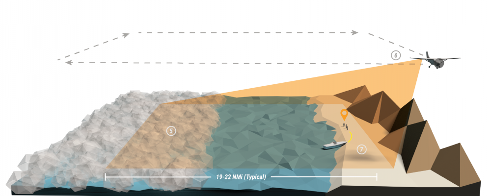
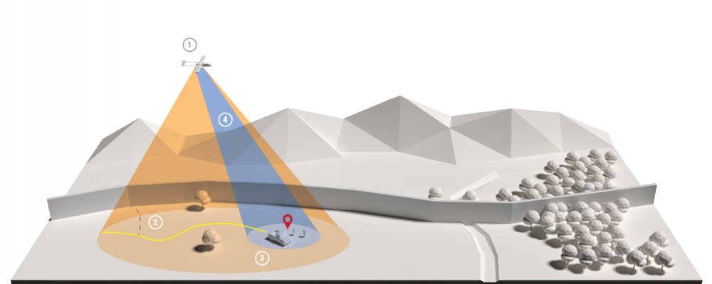
The diagram below illustrates a typical maritime patrol focused search CONOP, such as a search and rescue.

An intel hit comes in indicating that a vessel is likely inbound in a certain region during a certain timeframe, but the precise location is not known. Or, in a search-and-rescue CONOP, maritime patrol is searching for lost vessels, debris fields, life rafts, or persons at their last known location.
Mission specialists designate a search area box that will give a high probability of intercept, and fly the Maritime Patrol Radar (MPR) along the 4 edges of the search box, collecting SAR images and/or MMTI data, looking inward to minimize blind spots and time spent in transit.
The MPR indicates possible targets and uses MMTI mode to provide geolocated detections and tracks containing bearing and speed information.
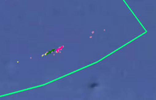
The sensor operator uses the detections and tracks to cross cue an EO/IR sensor. MPR data is compared with EO/IR and AIS data to identify the target. Relevant targets are then monitored and information is relayed to authorities.
In a similar but extended CONOP, mission specialists in counter-drug or counter-trafficking efforts employ radar to accomplish steps 1 – 4 as described in the Maritime Patrol Focused Search above, with the mission continuing.
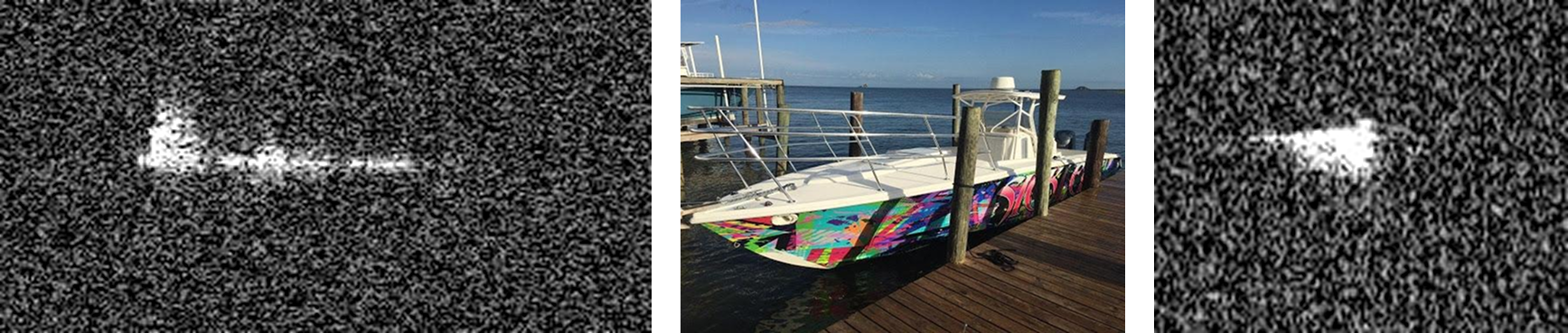
Fog rolls into the region. When environmental conditions such as high humidity, haze, fog, cloud cover, or darkness inhibit the effectiveness of the EO/IR system in identifying or classifying a target, sensor operators employ an Inverse SAR mode (ISAR), giving them the ability to focus on a target of interest. The radar transitions to a spotlight SAR mode on the target and begins outputting ISAR frames that can be used to identify the vessel. (In traditional SAR mapping mode, targets on water are blurred due to the vessel’s motion. The Inverse SAR mode relies on the pitching and rolling motion of the vessel to focus the imagery and identify features such as the size and number of masts).
To further detect targets, operators employ the radar to perform wide-area, coarse-resolution SAR mapping with Sector Scan to cover large swaths of the ocean and littoral environments, looking for slow and small targets. (Unlike camera systems, the radar is able to detect objects smaller than imaging resolution cell size, or sub-pixel sized objects. This allows small objects to be detected even when operating in a coarse resolution, wide-area mapping mode. Because the radar uses a tactical grade navigation solution and does not need to rely on autofocus algorithms during SAR image formation, it is able to form high quality images over low-return, water-only scenes as well as in littoral environments. This is one of the key advantages to having a multimode radar system as opposed to a conventional rotating radar.)
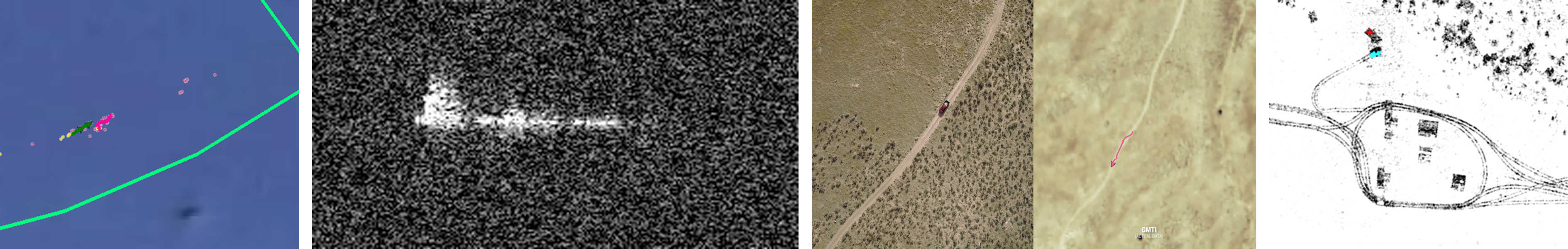
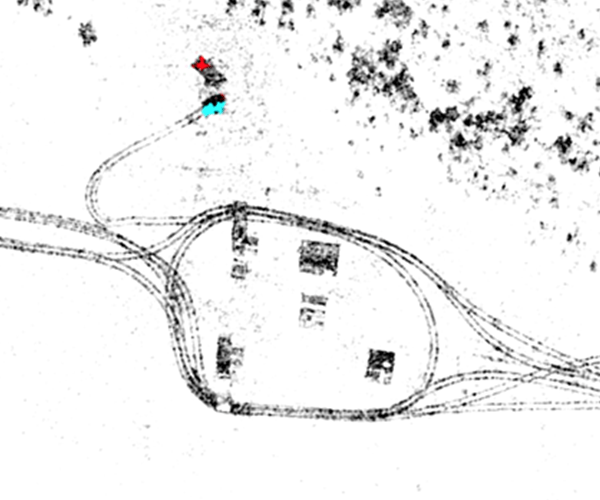
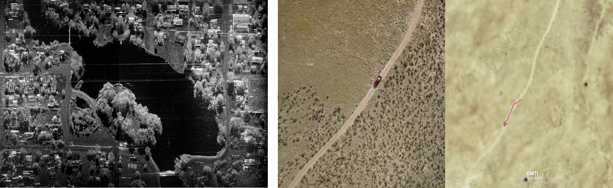
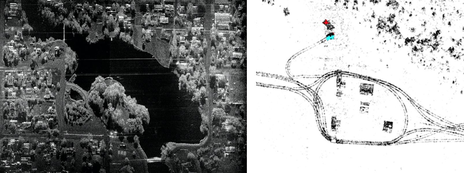
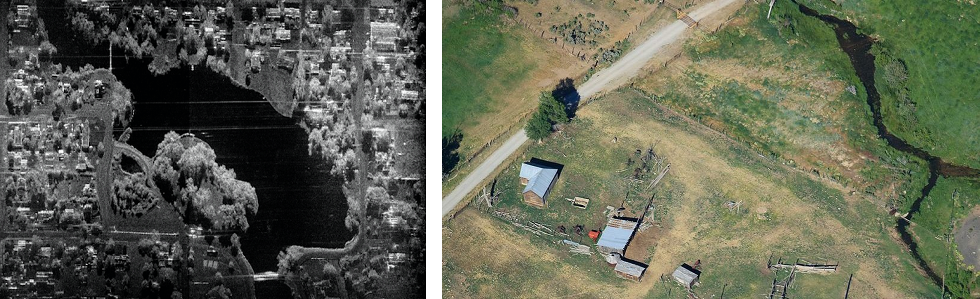
Motion tracking indicates that a vessel has reached the shore. Using MMTI and ISAR for maritime and GMTI/DMTI and CCD for land, mission specialists can continue employing the radar in both littoral and inland environments to identify the source of illegal operations. Analysts combine multiple high resolution SAR passes to generate change detection (GMTI and CCD) products that highlight boat launch points along coast lines or river banks. They can also monitor unimproved air fields, roads, and other facilities to establish patterns of life and attack the network supporting illegal operations. Relevant targets are then monitored and information is relayed to authorities.
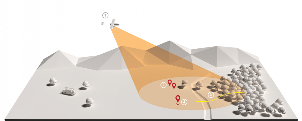
In a land-based CONOP, mission specialists employ multiple radar modes to patrol borders.
Mission specialists fly a manned aircraft parallel to the border, mapping the area with SAR imaging on consecutive flights. They cover both sides of the border searching for ingress and egress points.
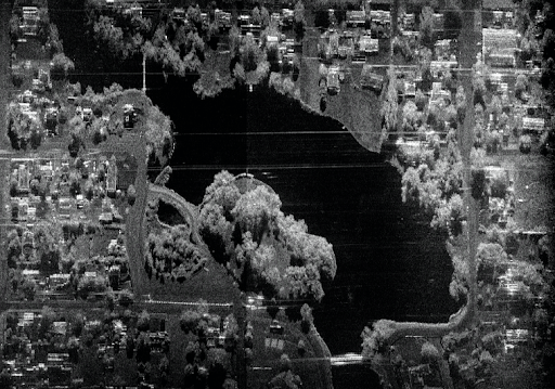
An analyst uses CCD images to identify areas where illegal border crossings have occurred between flights. CCD is capable of tracking pedestrian traffic in open and mountainous terrain.
By using traffic patterns discovered with previous CCD passes, the analyst identifies areas to target and employ GMTI/DMTI to detect, classify, and track any suspicious vehicle or dismount activity across large swaths of land.

An analyst verifies activity from sensor detections by cross cueing and EO/IR sensor.

Mission specialists direct ground units to further investigate.
Unmanned aircraft equipped with radar and EO/IR can perform multiple operations to protect personnel and equipment.
Mission specialists fly a single Group 1-3 UAS to perform wide-area scans with SAR imaging and GMTI to determine pattern of life.
From a ground station, an analyst directs the radar to employ SAR and CCD along patrol and supply routes to detect ground disturbances indicating areas where roadside IEDs or other hazards may have been emplaced.
An analyst uses GMTI/DMTI modes to detect and track any suspicious activity in the vicinity of forward operating bases, observation posts, patrol bases and other fixed installations.

An analyst directs the radar to cross cue an EO/IR and/or provide the precise location and image the area of interest.
Ground units can further investigate or provide intelligence to appropriate authorities.
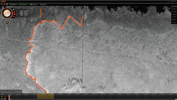
Manned aircraft equipped with complementary radar and EO payloads are ideal for monitoring natural disasters.
In a manned aircraft, mission specialists use EO and SAR imaging to map the disaster area in real time.
Analysts overlay the EO images with SAR images to identify flood/fire lines.
Mission specialists revisit the disaster sites at periodic intervals to update maps.
Specialists analyze the progression of flood or fire lines by comparing the SAR images from different intervals, producing CCD products.

For more information, contact IMSAR sales@imsar.com.

.png)