KNOWLEDGE BASE CONTENTS
Knowledge Base / Interpreting & Analyzing Radar Data / Mission Management Software
3.4 Taking Advantage of Mission Management Software
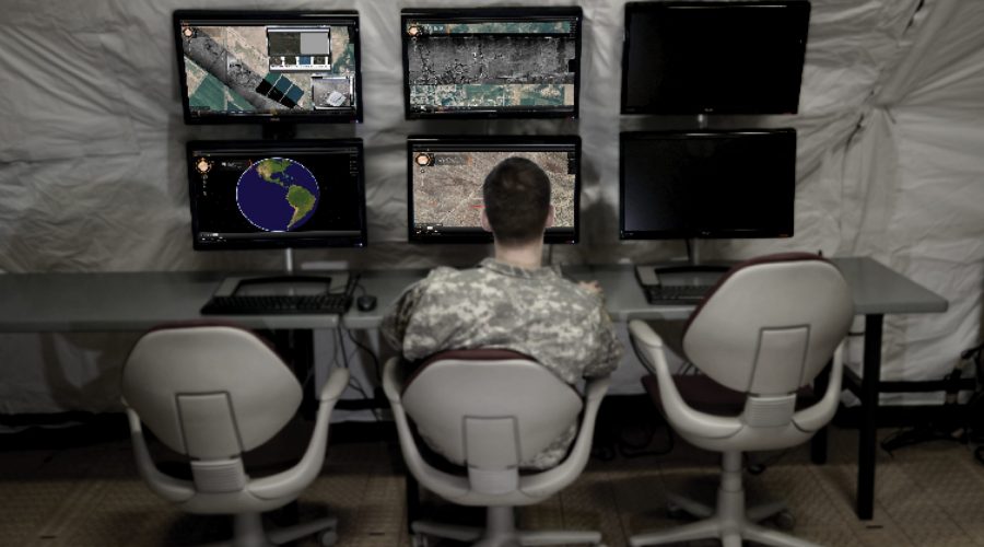
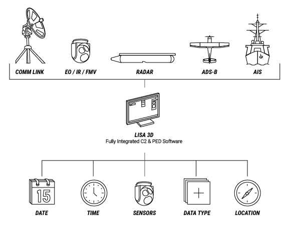
User-friendly, state-of-the-art mission management software enables radar analysts to more quickly and easily interpret data which promotes mission success. This software is available from several industry providers. IMSAR radar systems come pre-installed with Lisa 3D, IMSAR’s C2 and PED mission management software. Through its C2 functions, operators can plan flights for data collection, operate the radar, cue third-party sensors and monitor the health of the system. Through its PED functions, Lisa 3D displays data in seconds with a timeline-based workflow and intuitive search tools. Also, the software reduces operator workload by displaying data not only from the radar, but also from a variety of other sensors, such as EO/IR, FMV, and AIS.
As an alternative to using Lisa 3D for C2 functions, IMSAR radar system users have the option of using IMSAR’s Radar Control API, which allows for interoperability with other C2 ISR mission management software suites. Through the API, operators can use third-party software to slew the radar to an area of interest and immediately begin collecting data, and access data products and system status information. Additionally, IMSAR system data outputs are standards compliant, enabling data analysis in third-party PED software and the sharing of data products.

Intuitive Mission Management Software Aids Data Interpretation and Analysis
IMSAR’s Lisa 3D
Lisa 3D software is a multifunctional tool from which operators can complete the following tasks:
- Perform flight planning for multiple modes and sensors
- Display flight data in real time
- Analyze, annotate, store, and export data products
- Search data from previous flights by collection time and date, sensor type, data product, collection area, or specific aircraft
- Ingest and display geolocated data from GPX, shapefile, AIS and ADS-B simultaneously

With Lisa 3D, operators can send and receive messages to and from sensors, platforms, datalinks, and other operators via embedded functions, cursor-on-target, and chat messages. During operations, Lisa 3D allows the operator to monitor data collection activities, including sensor health, flight accuracy relative to flight plan, velocity, altitude, and other flight characteristics.

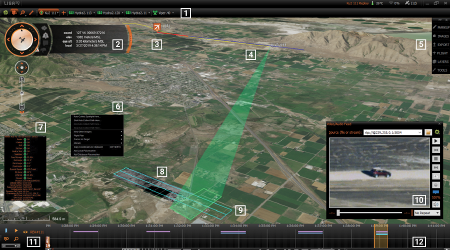
IMSAR’s Lisa 3D Software Features: (1) a sensor bar, (2) a heads-up display, (3) flight planning tools, (4) asset tracking tools, (5) PED tools, (6) multi-sensor coordination tools, (7) sensor status displays, (8) real-time data displays, (9) data collection planning tools, (10) a video player, (11) search tools, (12) a timeline
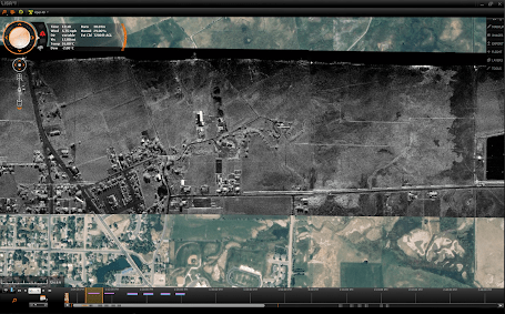
In addition, as the radar sensor data is being collected, Lisa 3D can display the data from multiple sensors superimposed on an optical basemap, including EO/IR imagery, FMV, SAR imagery,CCD imagery, and GMTI detections and tracks. This overlay feature allows the user to quickly compare data from multiple sensors to gain greater situational awareness of objects and targets of interest in the collection area.

Lisa 3D with SAR Stripmap Data Overlaid on an Optical Basemap
Since IMSAR radars have multimode capabilities and can communicate with other sensors, IMSAR developed Lisa 3D to accept multiple data inputs. Lisa 3D can import data from virtually any sensor that has an IP address and an ability to export data. Lisa 3D can convert and display basemap imagery and elevation data in standard formats including CADRG, CIB, MrSID, SID, NITF, TIFF and GEOTIFF. Other data inputs Lisa 3D can be configured to accept include asset tracking such as AIS, ADS-B, or GPS data feeds, and it can maintain and monitor the line-of-site or beyond-line-of-site communications links to the aircraft.
After mission specialists collect sensor data, they can use Lisa 3D to store the data and to search for the data by date, time, sensor, platform, location, and data type. Lisa 3D also has built-in filters to allow filtering by date and time, calendar date or date range, location, data, sensor type, and by several characteristics for GMTI playback including play type, speed, time window width, and GMTI track speed.
Interoperability with Other C2 and PED Software Suites
Several other mission management software suites are available on the market to help analysts interpret radar and other sensor data. Software products can be C2 only, PED only, or have both C2 and PED functionality. IMSAR customers have the option to use these third-party suites through IMSAR’s Radar Control API. The API software comes with a detailed Interface Control Document (ICD) to describe available commands and message functions to integrate other sensors or systems with IMSAR radars, and sample API messages to speed development and testing. Using the API, external C2 software can command SAR and MTI data collection activities, observe system health and status, and access all radar system data products: SAR and CCD imagery, and MTI detection and track streams. The API is designed with open standards for messaging and data products, allowing for transition to standardized formats such as OMS. In addition, IMSAR radar systems produce standard data products, allowing for third-party PED software use.
| IMSAR Radar System Open Standards Interface | |
| Standard Inputs | Power and Ethernet, Radar API |
| Standard Data Products | KML, Complex NITF, JPG, PNG, BMP,
STANAG 4607 MTI Detects, STANAG 4676 MTI Tracks |
Today’s radar sensors are linked to mission management software that displays data intuitively, helping to reduce the cognitive loads of mission specialists. Additionally, radar suppliers might offer training on interpreting radar imagery and related data products and provide in-field support to help new users get some hands-on experience. With these accessible resources, novice image analysts can quickly gain valuable skills to support critical missions without obtaining a specialized degree.
Contact us at sales@imsar.com for more information.
Related Content
Updated Sept 14th, 2021
